Precision, Reliability, and Technology-Driven Results
At JMT, land surveying is more than a technical service—it’s the foundation of every successful project. Our licensed surveyors and experienced field crews deliver accurate, timely, and comprehensive data to support infrastructure, development, and environmental initiatives across the country.
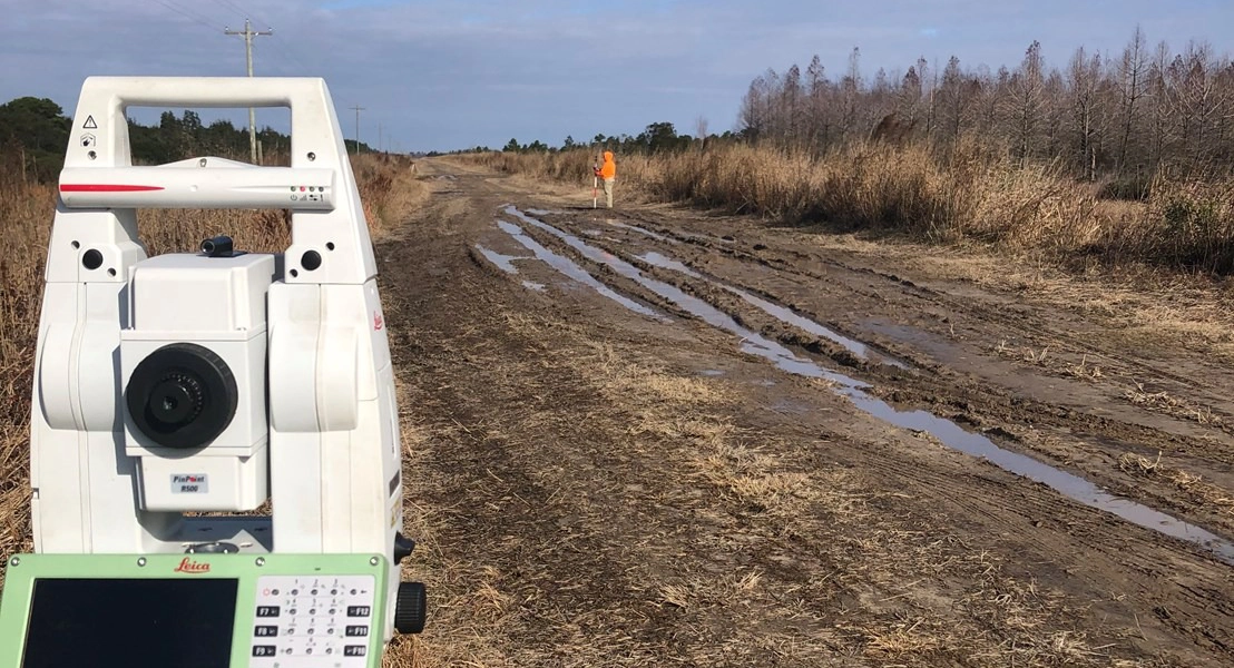
We offer a full range of surveying services, including topographic and boundary surveys, GPS and GNSS-based control, construction stakeout, ALTA/NSPS land title surveys, right-of-way and easement plats, and 3D terrain modeling. Our teams are equipped with advanced tools such as robotic total stations, mobile LiDAR, and drone-based photogrammetry to capture high-resolution data in real time.
JMT’s surveyors are deeply experienced in supporting transportation, utility, and site development projects. We routinely perform utility location surveys, environmental mapping, and detailed site reconnaissance to document existing conditions with precision. Our deliverables are tailored to client needs and can be provided in AutoCAD, MicroStation, OpenRoads, or GIS-compatible formats.
Whether you’re planning a roadway expansion, designing a new facility, or preparing for construction, JMT’s land surveying team brings the accuracy, responsiveness, and technical depth to move your project forward with confidence.
Let’s start with a solid foundation.
Transportation Areas of Focus
Intelligent Transportation Systems
Subsurface Utility Engineering
Connect With Us